- You are here:
-
MTBC Home

-
Mountain Biking Blog
-
General
- Let Trailforks Help You Find Your Way on the Trail
Let Trailforks Help You Find Your Way on the Trail

Most mountain bikers have their "go to" trails that they do on a regular basis and many people are fine with doing the same trails over and over. But if you are like us you are always looking for something new and exciting and usually head over to YouTube or Google Maps to try and see what else is out there.
One great resource that you might want to try to find some new trails is called TrailForks and it's from the people who run Pinkbike and if you don't know what Pinkbike is you need to go to their website right now and check it out. TrailForks is a mountain bike website designed to help you find trails as well as trail conditions, photos, videos and more. It kind of sounds a little like this site! There is also an app for it as well so you can actually use your smartphone and GPS on the trail to see where you are in relation to the trails on their site you are looking for.
Once you log into the TrailForks site you can enter the area you are looking for or let it find you based on your location. You can see a map of the area with all the known trails listed along with their skill level based on colors.
Purple - fire road
Green - beginner\easy
Blue - Intermediate
Black - black diamond
Red - double black diamond
You can click on each trail to go into details about that trail such as its length, elevation gain, physical difficulty, rating, trail status and other useful information. You can also view photos and videos of the trail if there are any posted. And if you join the site you can post your own photos and videos as well as give trail reports to help out other riders. Plus if you have a trail that is not on the site you can add it so others can benefit from your information.
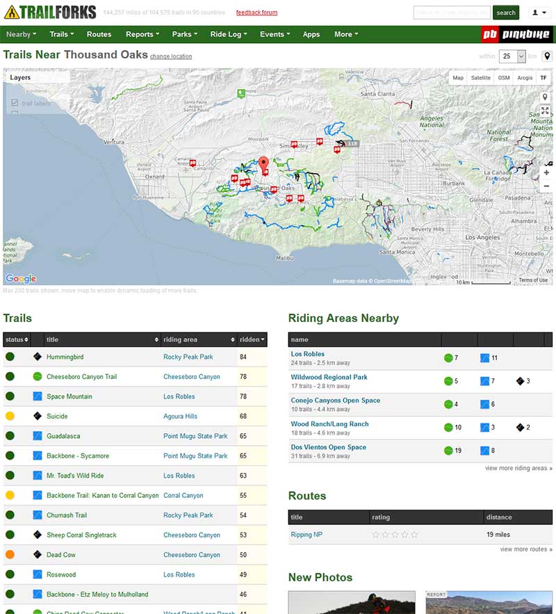
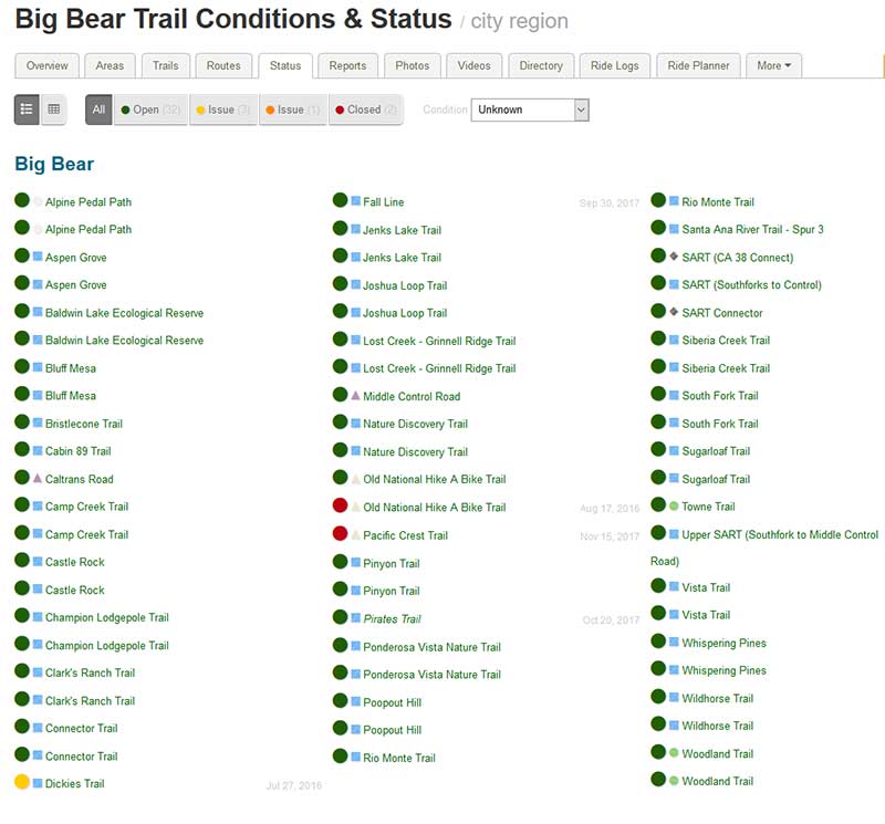
TrailForks also has riding areas which are geographic locations that have trails within that location making it easy to find many trails within close proximity to each other. Once you pick a region you will be presented with many tabs that have various information about that region.
One of the more useful tabs is the Status tab which will show you all the trails in that region along with their current status. They are color coded so you know if they are all clear, are closed or have a specific issue such as being overgrown or washed out. Just be sure to check the dates so you know the information you are looking at is current. If you have been on those trails you can update the conditions as well.
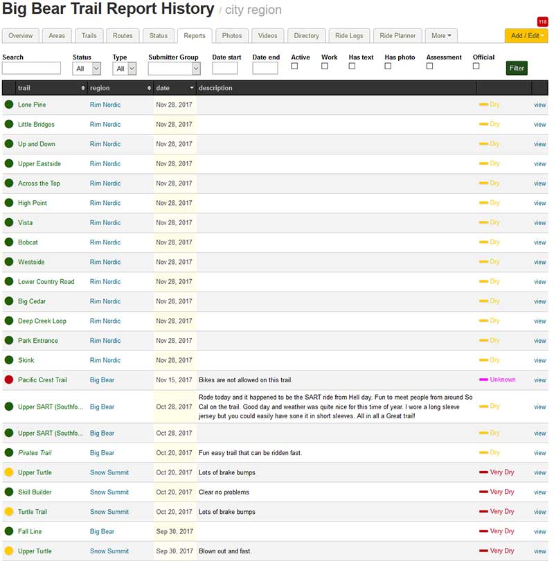
The Reports tab also comes in handy and is similar to the Status tab but you get more detail information from other rides who have been on those trails. You can even sort the columns to make it easier to read such as having the newest reports show up at the top of the list. You can click on individual trails to get more detailed information.
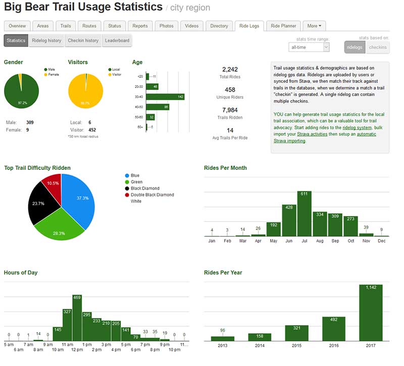
The Ride Logs tab is interesting because it shows some pretty interesting information such as how many people have ridden the trails and how many were men compared to women. You can also see age related information and how often the trails in the area have been ridden. Riders can also post their ride logs with what trails they rode and how many miles they put in. If you use Strava you can tie it into TrailForks and have your own ride information put on the site as well.
There is a lot more to the TrailForks site than what we went over so if you like what you see you should sign up for a free account and also download the app on your phone so you can use it on the trail. And if you are looking for something new to ride in your area or even out of town then it's a great place to start your research and it can also help you find your way when you are out there trying to find the trail you discovered on the TrailForks site.
Posted by Preston Mason