
|
Cannell Trail, Filmed and Rated by Mike Treiber Review Date: 9/1/2013 |
|
| Trail Ratings | |
|
Fun: |
Technical: |
The Cannell Trail is one of those rides that you must do at least once and after you do it you will want to do it again. This ride offers a variety of riding conditions and scenery along the way. If you do the ride from the drop off point where the shuttle takes you then it's a 27 mile ride. If you decided to ride up to the summit then prepare to ride an extra 2.5 miles up with a 900 ft. elevation gain to around 10,000 feet. Then again you get to add 2.5 more miles down on the way back. This is not something you want to ride up and down so spend the $40 and take the 1:20 drive to the top and ride down.
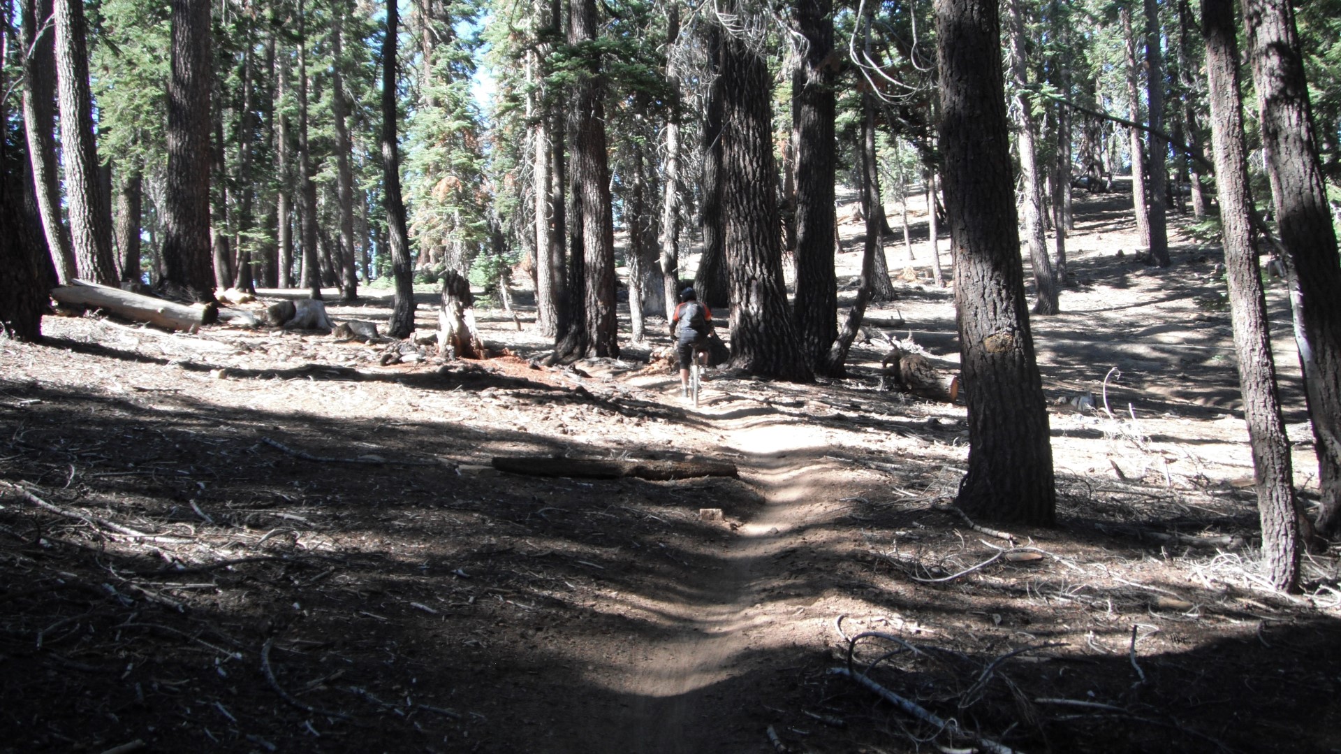
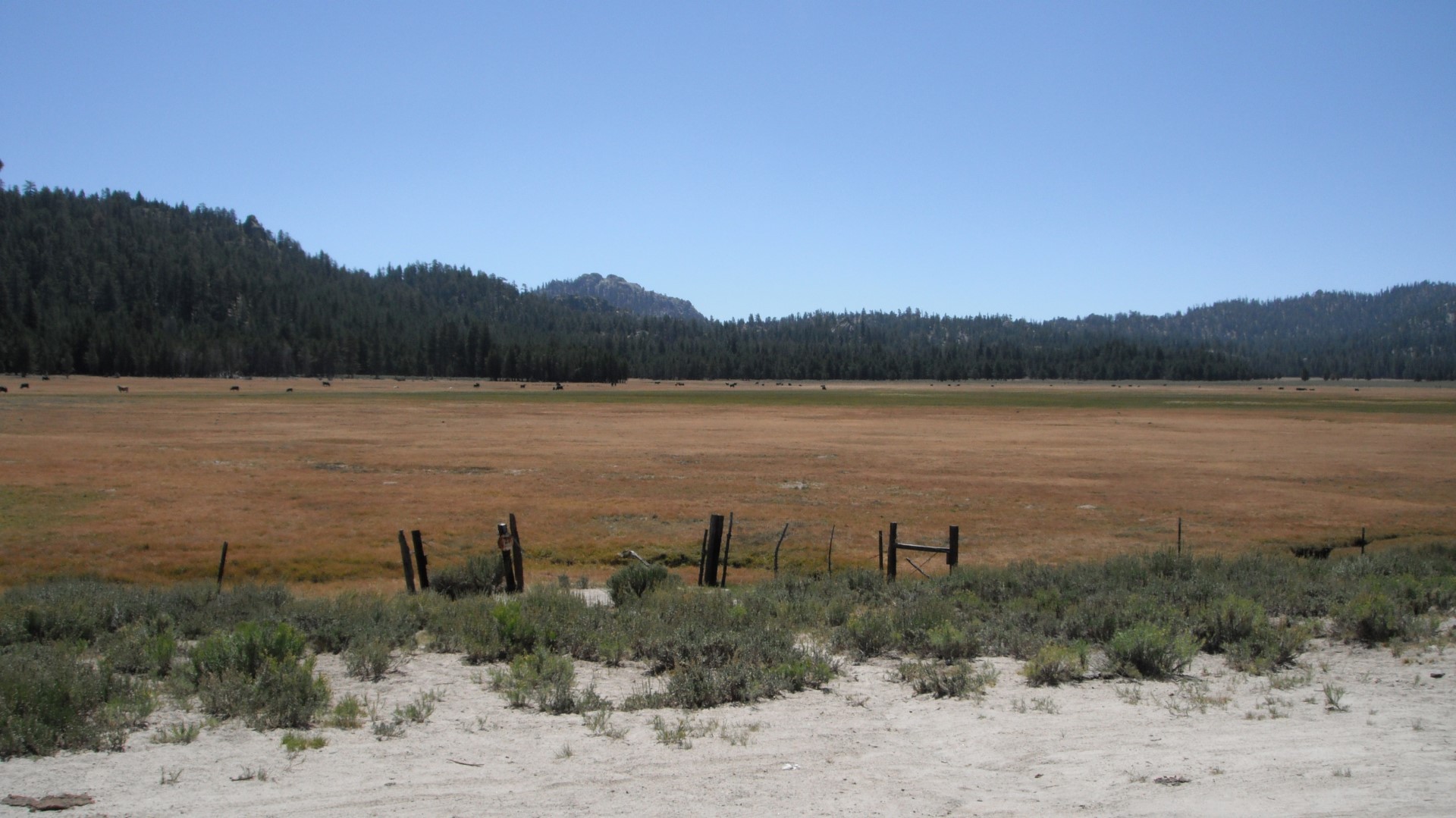
The Cannell Trail starts with a ride through the trees of the southern Sierra Nevada mountain range and takes you down into the valley in Kernville where the conditions change from trees all around to more desert like. The trail conditions change as well from smooth to sandy to rocky.
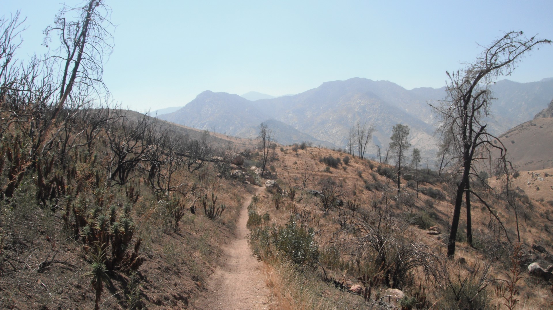
The Plunge is the last part of the trail where the elevation drops 5,000 feet in around 8 miles so it's a downhill free for all to the very end. Don't go thinking it's all downhill from the top though. You will have around 3-4 miles of climbing with some ups and downs in between and at the higher elevations it can be rough.
If you have never done the ride it will take the average rider around 6 hours to do with all the stopping for breaks and looking at the map to make sure you are going the right direction. You also need to take plenty of food and water since this ride will take it out of you. There is a natural water spring part way in that you can top off at but other than that you are on your own. You should also bring sunblock, bug spray and a snake bite kit just to cover your bases.
Cannell Trail Video
Cannell Trail Review
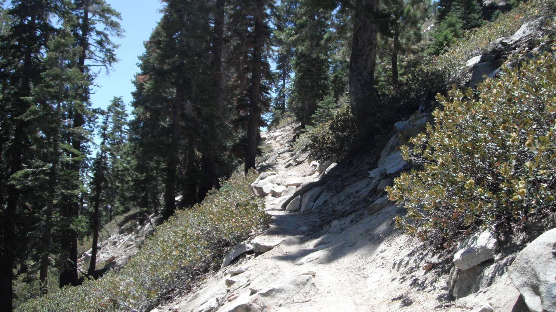
Like mentioned before the Cannell Trail is a ride you need to do at least once since it's a nice challenge (and test of your endurance) and offers some great riding with a nice variety of trail types. Right off the bat you get a nice section of semi downhill riding with some rocky areas and then it will smooth out for a while. As you go along you will encounter some uphill singletrack which you most likely will walk part or all of before it levels out again. Since you are at a higher elevation even walking up the trail can be exhausting if you are not used to that altitude.
There are a few sections of the trail that offer some downhill rocky technical riding and you have the choice of taking your time and going slow or just hitting the gas and having some fun with it assuming you have the appropriate bike. Just be careful not to hurt yourself because you won't come across too many people if any when out there so help will be hard to find. And for the most part cell phone coverage is nonexistent so that won't be an option.
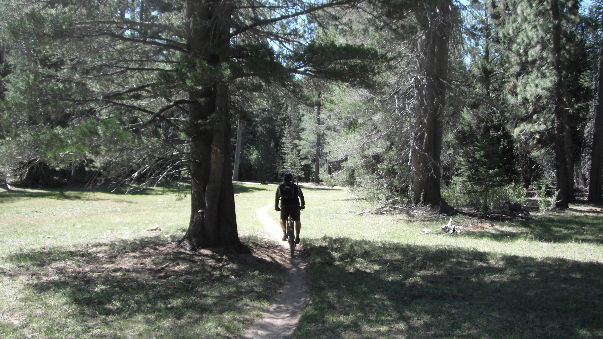
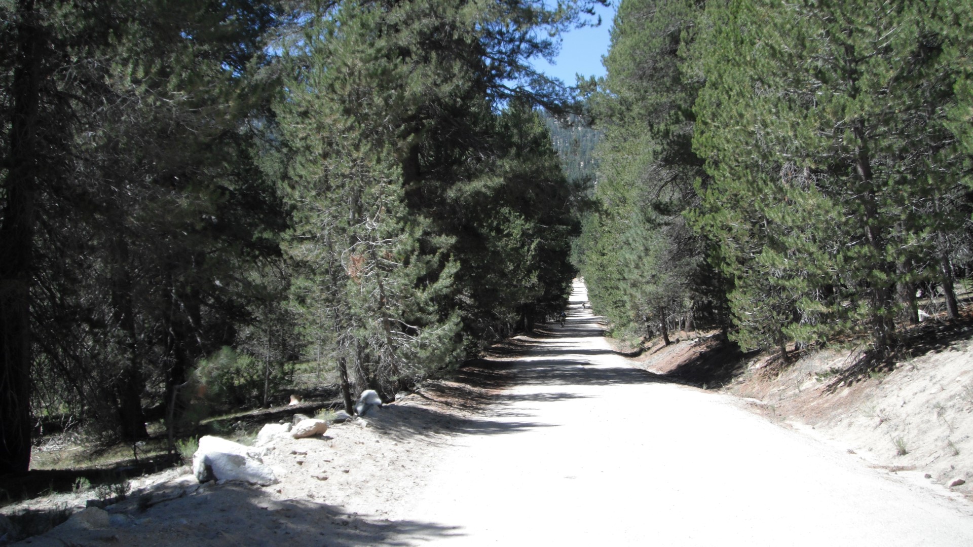
Other sections of the trail are not as fun (depending who you ask) and can be very rutty and have a lot of loose sand which makes for a challenge or an accident depending on your riding skills. You will also come across some meadows which offer a nice view and a nice level riding surface allowing you to enjoy the ride and the sights without straining yourself too much. And if you are into fire road riding then you will be getting a few miles of that as well. It's all uphill and not too steep but the altitude makes it harder than it normally would be. It's still easier than riding up the singletrack.
The last part or the Plunge as they call it is the best part since it offers nonstop downhill action (except for one short climb) with loose sand, rocks, switchbacks and really fast sections. The closer you get to the bottom the faster it gets because it's not as loose but still has some technical rocky sections. If your front tire is not designed for loose dirt or sand you will be having some issues with it getting loose when you hit the sandier areas. You also need to make sure your brakes are in good working condition before doing this ride because you don't want them to go out on you during the Plunge.
Although you won't see too many people wearing pads or full face helmets you may want to consider it if you plan on going for broke on the downhill sections because there is plenty of room for falls and serious injuries. You don't have to fly down the hills if you don't want to but it's more fun if you do so dress accordingly.
Cannell Trail Pictures
Directions to the Cannell Trail
View the Cannell Trail in a larger map
To get to the Cannell Trail you need to first get to Kernville which is just north east of Bakersfield and north of Lake Isabella. What you need to do is get on Highway 99 into Bakersfield and then take the 178E until you get to the Wofford Heights exit which is CA-155 W and take a left and that will take you right into Kernville.
If you are planning on doing a shuttle run to the top which is the only way to go then look up Mountain River Adventures and schedule your ride but keep in mind that they need a minimum of 5 people to make the trip up the mountain. When you are done with the ride it will dump you out on Sierra Way just outside of town and down the street from the Mountain and River Adventures Campground. From there you can ride back to the shuttle pickup point and load up in your car. Or if you are staying close to the trail exit you can ride back to where you are staying but just be sure to call Mountain River Adventures and let them know you made it back.